
Mumbai is well known for its high population density. There are 3.34 million in Mumbai's Island City, resulting in a massive density of 36,200 people in each square kilometer. This density is relatively constant across this central area of Mumbai, where the architecture consists of a contiguous patchwork of medium-height, mixed-use building structures. Equally omnipresent are the informal settlements woven throughout the urban fabric, which comprise 20 percent, or 74 square kilometers, of the city’s geography—yet accommodate as much as 65 to 75 percent of the population. These settlements are largely limited to low-rise structures that on average are not taller than two stories, meaning those areas have a high density of tightly packed inhabitants.
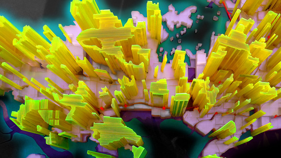
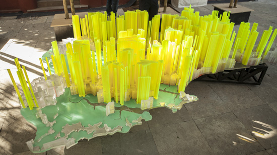
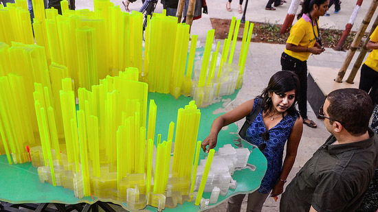
To make this information more accessible, the Lab has developed a new index of population density based on Floor Space Index (FSI is the term used in India, while the term Floor Area Ratio (FAR) is more common in other countries). Using Google Earth to create a detailed map of the current population density of Mumbai, Lab Team member Neville Mars spearheaded this methodology, which examines the average density in gridded map cells of 500 square meters. These numbers form the basis of a new index, dubbed “Stacked Population Index” (SPI). The model derived from this data provides an accurate depiction of Mumbai’s density, revealing precisely how it varies and reflects living conditions throughout the city.
This work was created by Neville Mars in connection with the BMW Guggenheim Lab project, a project of the Solomon R. Guggenheim Foundation, and is licensed under a Creative Commons Attribution 3.0 Unported License.
Photo: Neville Mars